-
Jon Barnett on Climate Change, Small Island States, and Migration
›
Contrary to the iconic image of lapping waves submerging low-lying countries, few Pacific islanders are emigrating from their homes due to climate change, according to Australian geographer Jon Barnett of the University of Melbourne.
-
Pakistan After the Floods: A Continuing Disaster
›September 29, 2010 // By Hannah Marqusee
A month after Pakistan’s worst flood in 80 years, millions remain without access to food, clean water, or health care.
-
Historic Floods Plague Pakistan
›August 19, 2010 // By Shawna Cuan“Staggered by the scale of destruction from this summer’s catastrophic floods, Pakistani officials have begun to acknowledge that the country’s security could be gravely affected,” reports the Washington Post. The Pakistani government – already cash-strapped between fighting “the war on terror” and trying to prevent an economic collapse – now faces recovering from the worst flooding in over 80 years.
-
Floods, Fire, Landslides, and Drought: The Guardian’s “Weather Crisis 2010”
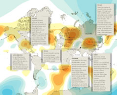
› From the Guardian’s DataBlog comes an excellent overview of some of the extreme weather affecting the globe this summer, from the devastating floods in Pakistan which have inflicted “huge losses” to crops and exacerbated an already tenuous security situation, to the wildfires in Russia which have smothered the capital in dangerous smog and crippled domestic wheat supplies.
“Global temperatures in the first half of the year were the hottest since records began more than a century ago,” writes author and graphic artist Mark McCormick.
The orange areas of the map represent high pressure systems and the blue, low pressure systems, which as explained by Peter Stott of the Met Office, are important indicators of the rare climatic conditions that caused this summer’s abnormal conditions across Eurasia.
The flooding in Pakistan has garnered the most international attention, having now affected more people than the 2004 tsunami, 2010 Haiti earthquake, and 2005 Kashmir earthquake combined. Other highlighted areas of the map include flooding in Poland and Germany, drought in England, mudslides in Latin and South America, record-breaking drought and hunger in West Africa, and flooding and landslides in China, which recently pushed the world’s largest hydroelectric dam to its limit and have now been blamed for more than 1,000 deaths.
Although it does a good job highlighting the frequency and severity of extreme weather events this summer, it’s important to note that the map only covers events in July and August. That leaves out the “1000-year” floods in Tennessee this May as well as the heavy snowfall seen in the Northeast United States and the winter of “white death” in Mongolia earlier this year, which also severely disrupted local and national infrastructure as well as a great many people’s livelihoods.
Sources: Agence France-Presse, BBC, Guardian, National Oceanic and Atmospheric Administration, New York Times, Telegraph, UN Dispatch.
Image Credit: “Weather Crisis 2010” by Mark McCormick, courtesy of Scribd user smfrogers and The Guardian. -
Flooded With Food Insecurity in Pakistan
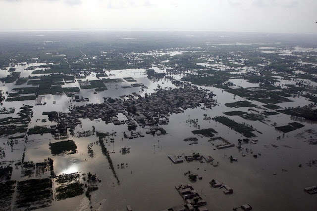
›The floods sweeping across Pakistan have caused widespread destruction, ruined livelihoods, displaced millions, and sparked a food crisis. Food prices have skyrocketed across the country as miles of farmland succumb to the deluge, including 1.5 million hectares in Punjab province, Pakistan’s breadbasket and agricultural heartland.
Food insecurity is now rife across the country — yet even before the floods, millions of Pakistanis struggled to access food. Back in 2008, the UN estimated that 77 million Pakistanis were hungry and 45 million malnourished. And while many developing nations have begun to recover from the global food crisis of 2007-08, Pakistan’s food fortunes have remained miserable. Throughout 2010, Pakistan’s two chief food staples, rice and wheat, have cost 30 to 50 percent times more than they did before the global food crisis. Drought, rampant water shortages, and conflict have intensified food insecurity in Pakistan in recent months.
A new edited book volume published by the Wilson Center’s Asia Program, Hunger Pains: Pakistan’s Food Insecurity, examines the country’s food insecurity. The book has already been the subject of a news story and an editorial in the Pakistani newspaper Dawn. The book, edited by Michael Kugelman and Robert M. Hathaway, is based on the 2009 Wilson Center conference of the same name. It assesses food supply challenges, access issues, governance constraints, social and structural dimensions, gender and regional disparities, and international responses.
The book makes a range of recommendations. These include:- Declare hunger a national security issue. Since some of Pakistan’s most food-insecure regions lie in militant hotbeds, hunger should be linked to defense, and food provision projects should be given ample public funding.
- Diversify the crop mix so that Pakistan’s agricultural economy revolves around more than wheat and rice. The country should accord more resources to crops that are less water-intensive and more nutritious.
- Give schools a central focus in food aid and food distribution. Using schools as a venue for food distribution gives parents powerful incentives to send their children to school.
- Tackle the structural dimensions. Strengthening agricultural institutions, improving infrastructure and storage facilities, and injecting capital into a stagnant farming sector are all key to making Pakistan more food-secure. Yet unless Pakistan deals with poverty, landlessness, and entrenched political interests in agriculture, food insecurity will remain.
Michael Kugelman is program associate with the Asia Program at the Woodrow Wilson International Center for Scholars.
Photo Credit: “Chitarl, Pakistan” where floods damaged the way over Lawari pass and killed five in August 2006. Courtesy of flickr user groundreporter -
Reform Aid to Pakistan’s Health Sector, Says Former Wilson Center Scholar
›August 5, 2010 // By Wilson Center StaffExcerpt from op-ed by Samia Altaf and Anjum Altaf in Dawn:
WE must state at the outset that we have been wary of, if not actually opposed to, the prospect of further economic assistance to Pakistan because of the callous misuse and abuse of aid that has marked the past across all elected and non-elected regimes.
We are convinced that such aid, driven by political imperatives and deliberately blind to the well-recognised holes in the system, has been a disservice to the Pakistani people by destroying all incentives for self-reliance, good governance and accountability to either the ultimate donors or recipients.
Even without the holes in the system the kind of aid flows being proposed are likely to prove problematic. Over half a century ago, Jane Jacobs, in a brilliant chapter (Gradual and Cataclysmic Money) in a brilliant book (The Death and Life of Great American Cities), showed convincingly how ‘cataclysmic’ money (money that arrives in huge amounts in short periods of time) is a surefire way of destroying all possibilities of improvement. What is needed, she argued, is ‘gradual’ money in the control of the residents themselves. While Jacobs was writing in the context of aid to impoverished communities within the US, she concluded with a remarkably prescient concern: “I hope we disburse foreign aid abroad more intelligently than we disburse it at home.”
Continue reading on Dawn.
For more on U.S. aid to Pakistan, see New Security Beat‘s coverage of the recent U.S.-Pakistani Strategic Dialogue.
Photo Credit: A U.S. Army Soldier with 32nd Infantry Regiment, 10th Mountain Division, hands out medical supplies to Pakistani refugees outside an International Committee of the Red Crescent aid station in Afghanistan’s Kunar province, October 23, 2009. Courtesy of flickr user isafmedia. -
A Return to Rural Unrest in Nepal?
›July 27, 2010 // By Russell SticklorIn the four years since the end of Nepal’s civil war, political progress in creating a multi-party unity government in Kathmandu has moved in fits and starts. While the effort to bring the Maoists into the fold has made some headway since 2006, continuing environmental and economic troubles in the Nepalese countryside threaten to undermine these tentative steps.
In recent months, a new threat to political stability has emerged: the Sapta Kosi Multipurpose Project, a massive, India-backed hydropower scheme in eastern Nepal currently in the early stages of development. Once operational, the controversial dam—slated to reach a height of nearly 270 meters, making it one of the tallest dams in the world—is projected to generate 3,300 megawatts of electricity.
A proposed barrage and series of canals round out the project, enabling new irrigation and flood-control infrastructure in both eastern Nepal and the Indian state of Bihar, immediately to the south. But the potential environmental impacts of the mega-project have already sparked significant backlash among some Maoist-linked ethnic groups in the region, where the reach and influence of Nepal’s fledgling unity government is tenuous at best.
“Strong” Protests Threatened Over India-Backed Mega-Dam
In June, a network of 15 groups sympathetic to the Nepalese government’s Maoist wing warned of “strong” protests if survey work on the dam continued and “the voice of the indigenous people was not heard.” A memo released by the group dismissed the Sapta Kosi project as “anti-people.”
Specific criticisms of the project have ranged from safety concerns (the dam would be built in a seismically active region) to population displacement. Maoist leaders in the region have alleged that many villages—as well as important local religious sites and valuable agricultural land—could be flooded if the project goes forward. Other Maoists say the project should be delayed until Nepal is reorganized as a federal republic, at which point the states directly impacted by Sapta Kosi could be given greater control over the project.
Meanwhile, some objections to the project have targeted Nepal’s partnership with India. According to ShanghaiNews.net, members of the Maoist opposition have insinuated that hydropower from Sapta Kosi will not be consumed domestically, but rather exported to meet the needs of energy-hungry India.
A number of prominent Nepalese and Indian environmental activists have also spoken against the project, including Medha Patkar, a well-known activist who has played a major role in many past Indian anti-dam protests. Patkar warns the project will not mitigate but instead worsen seasonal flooding, calling plans for the joint India-Nepalese dam project “inauspicious from [an] environmental, cultural and religious point of view,” according to the Water & Energy Users’ Federation-Nepal.
As Nepal Pledges Security for Dam Project, India Pushes Forward
In the past, threats against the Sapta Kosi project have caused surveillance work in the area to be suspended repeatedly. But after the latest round of warnings, the Nepalese government adopted a different tactic, pledging heightened security in the region to ensure the safety of Indian officials doing fieldwork.
In doing so, Nepal’s coalition government is throwing its limited weight around, and—to a degree—staking its reputation on its ability to prevent an outbreak of violence. Historically, Nepal’s government has been largely bypassed or ignored in matters of hydroelectric development. As Nepal Water Conservation Foundation Director Dipak Gyawali told International Rivers in a June 2010 interview:The main players are private investors, with state entities and civil society unable to stand up to them….In Nepal, we just saw local politicians burn down the office of an international hydropower company even after the project was sanctioned by their leaders in the central government.
Gyawali added that during the Nepalese civil war (1996-2006), private developers were able to build “small hydropower projects even while a Maoist insurgency was raging because they did not ride roughshod over local concerns.” Regarding Sapta Kosi, Gyawali said the government should adopt a similar approach, and “start listening to the marginalized voices.” Otherwise, he warned, the Indian-Nepalese team spearheading the project “will be faced with delays, impasse, and intractable political problems,” including the potential for Maoist violence in the region. (As noted earlier this month in New Security Beat, the Indian government has also struggled with Maoist-linked violence in recent years, as New Delhi struggles to pacify a Naxalite insurgency in eastern and central India.)
Rural Nepal’s Troubles Far Bigger Than Sapta Kosi
Maoists may be wielding Sapta Kosi as a weapon to gain political leverage both in the countryside and Kathmandu, but the proposed dam is far from the only environmental issue impacting rural lives and threatening to undermine support for the central government.
In a country where firewood still accounts for 87 percent of annual domestic energy production, deforestation has been hugely problematic across rural Nepal. As of 2010, less than 30 percent of the country’s original forest-cover now remains. The rapid removal of forest cover has reduced soil quality, exacerbated seasonal flooding, and caused degraded water quality due to high sedimentation levels.
Further, as the country’s population grows at an annual rate of 2 percent, low soil productivity and unsustainable farming practices have turned Nepal’s effort to feed itself into a constant uphill struggle. According to the World Bank, the country sports one of the world’s highest ratios of population to available arable land, paving the way for potential further food shortages.
Sustainable energy development in Nepal perhaps represents one way of slowly restoring environmental health to the country. By investing in a more reliable national power grid, the central government could reduce rural dependence on firewood for fuel, allowing the country’s forests, soil, and waters to recover even as population increases. Further, hydroelectric projects like Sapta Kosi—implemented with greater involvement from local communities—could play an important role in moving the country forward. With an estimated untapped hydroelectric potential of 43,000 megawatts, Nepal could not only meet its own energy needs by developing its waterways, but profit from hydroelectric energy exports as well.
On the other hand, the Nepalese government could—at its own peril—continue to overlook rural populations’ grievances, and the environmental degradation unfolding outside Kathmandu. If left unchecked, however, these conditions could once again make the Maoist insurgency an appealing movement, potentially reviving grassroots support for anti-government extremism.
Sources: CIA, eKantipur.com (Nepal), International Rivers, Kathmandu Post, NepalNews.com, New York Times, ShanghaiNews.net, South Asia News Agency, Taragana.com, Thaindian News, Times of India, U.S. Energy Information Administration, WaterAid, Water & Energy Users Federation-Nepal, World Bank, World Wildlife Fund.
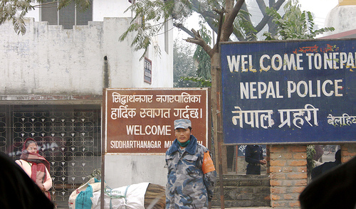
Photo Credit: “Neither in Nepal Nor India,” courtesy of Flickr user bodhithaj. -
Rear Admiral Morisetti Launches the UK’s “4 Degree Map” on Google Earth
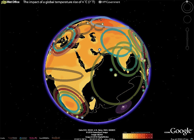
›Having had such success with the original “4 Degree Map” that the United Kingdom launched last October, my colleagues in the UK Foreign and Commonwealth Office have been working on a Google Earth version, which users can now download from the Foreign Office website.
This interactive map shows some of the possible impacts of a global temperature rise of 4 degrees Celsius (7° F). It underlines why the UK government and other countries believe we must keep global warming to below 2 degrees Celsius, compared to pre-industrial times; beyond that, the impacts will be increasingly disruptive to our global prosperity and security.
In my role as the UK’s Climate and Energy Security Envoy I have spoken to many colleagues in the international defense and security community about the threat climate change poses to our security. We need to understand how the impacts, as described in this map, will interact with other drivers of instability and global trends. Once we have this understanding we can then plan what needs to be done to mitigate the risks.
The map includes videos from the contributing scientists, who are led by the Met Office Hadley Centre. For example, if you click on the impact icon showing an increase in extreme weather events in the Gulf of Mexico region, up pops a video clip of the contributing scientist Dr Joanne Camp, talking about her research. It also includes examples of what the UK Foreign and Commonwealth Office and British Council are doing to increase people’s awareness of the risks climate change poses to our national security and prosperity, thus illustrating the FCO’s ongoing work on climate change and the low-carbon transition.
Rear Admiral Neil Morisetti is the United Kingdom’s Climate and Energy Security Envoy.
Showing posts from category flooding.


