Part of USAID’s
FRAMEweb community,
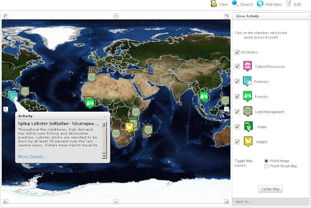
GeoExplorer is a visual aggregator of natural resource management (NRM) activities, best practices, success stories, and lessons learned. As of launch, GeoExplorer is home to 43 activities, each searchable by scale (e.g. local, national, or regional), sub-sector (e.g. forestry, water, wildlife), and topic (e.g. governance, livelihoods, and health).
GeoExplorer was designed to foster knowledge sharing among and between practitioners, program managers, and researchers. USAID expects the tool to help avoid cases both of repeating past mistakes and reinventing the wheel, serve as a guide for study trips to the field, build community exchanges, and foster networking. It is built on
ArcGIS architecture that USAID hopes will allow for continual expansion, particularly through the addition of GIS layers that can empower users with greater search options and tools for cross-project analytic analyses.
All activities on GeoExplorer are directly uploaded by users and USAID funding is not a requirement for inclusion. A FRAMEweb account (free) is all that is needed to sign-up and start adding your own projects. USAID hopes to make GeoExplorer available to host other NRM sub-sectors and even non-NRM activities in the future.
 A Publication of the Stimson Center.


