-
Band of Conflict: What Role Do Demographics, Climate Change, and Natural Resources Play in the Sahel?
›
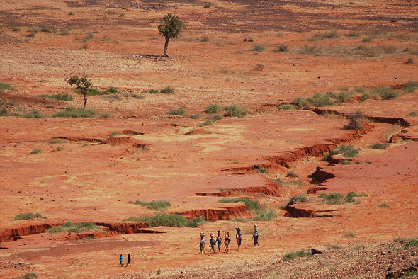
Stretching across northern Africa, the Sahel is a semi-arid region of more than a million square miles covering parts of nine countries. It is home to one of the world’s most punishing climates; vast expanses of uncharted and unmonitored desert; busy migration corridors that host human, drug, and arms trafficking; governments that are often ineffective and corrupt; and crushing poverty. It is not surprising then that the area has experienced a long history of unrest, marked by frequent military clashes, overthrown governments, and insurgency.
-
Africa’s Urban Youth Cohort, and Women’s Health in Forest Communities
› As recently discussed by the National Intelligence Council, sub-Saharan Africa is home to both the most rapidly growing populations in the world and its fastest expanding cities. Save the Children’s recent report, Voices From Urban Africa: The Impact of Urban Growth on Children, explores the challenges faced by the continent’s youngest age cohort, revealing what forces are driving children and families to migrate to urban areas and the poverty many are experiencing upon getting there. In response to the report’s findings, the authors recommend training and deploying more health care workers, facilitating public-private dialogue to identify long-term water and sanitation solutions, improving access to jobs and skills training, expanding access to early childhood care, and strengthening the education system to ensure widespread attendance. Compiled from 1,050 interviews, the report is unique for its first-hand accounts of the daily lives of children, their families, and community members.
 -
Tracking This Year’s Extreme Weather
›“Over the past several months, extreme weather and climate events seemed to have become the norm rather than the exception,” writes Kelly Levin for the World Resources Institute (WRI). Indeed, records have been broken around the world as countries experience unprecedented heat, drought, flooding, or other types of severe weather. And people are starting to take notice. A number of recent stories try to make sense of this wild weather and what, if anything, it has to do with climate change.
-
Jill Hagey, Behind the Numbers
Sahel Drought: Putting Malnutrition in the News
›The original version of this article, by Jill Hagey, appeared on the Population Reference Bureau’s Behind the Numbers blog.
Over the past few months, the Sahel drought has sparked attention of news media and concerned citizens around the world. Throughout this media blitz, I have been struck by the sharp contrast between this coverage and how the devastating effects of malnutrition are usually portrayed. Malnutrition is often overlooked in favor of more “newsworthy” diseases, and it takes a crisis to focus our attention on this public health issue. Yet an emergency such as this drought – affecting more than 18 million people, including nearly 2 million children – is difficult to ignore.
-
PBS ‘NewsHour’ Reports on Reasons for Optimism Amid Niger’s Cyclical Food Crises
›Set in the middle of the arid region between the Sahara desert and the equatorial savannas of Africa known as the Sahel, Niger is no stranger to drought. In recent years, however, droughts have hit more often, started earlier in the season, and lasted longer, creating a cycle of food insecurity that is becoming more difficult to break.
-
Visualizing Complex Vulnerability in Africa: The CCAPS Climate-Conflict Mapping Tool
›“Every crisis is complex, and the Sahel is no exception,” wrote USAID Assistant Administrator Nancy Lindborg in a recent Huffington Post article that called for “smarter programming and a coordivenated response” to chronic crises. “A regional drought has been overlaid with instability stemming from the coup in Mali and conflict in the northern part of that country where armed militant groups have forced the suspension of critical relief operations” and led to refugee movement into neighboring countries simultaneously challenged by drought and crop infestation. Understanding the complexity of this type of crisis, let alone visualizing the multiple factors that come into play, is a growing challenge for policymakers and analysts.
Enter version 2.0 of a mapping tool created by the Climate Change and African Political Stability Program (CCAPS) housed in the Robert S. Strauss Center for International Security and Law, based at the University of Texas, Austin.
In collaboration with the College of William and Mary, Trinity College, and the University of North Texas, and with funding by the U.S. Department of Defense’s Minerva Initiative, CCAPS originally launched the mapping tool in March of this year. The map is powered by mapping and data tools from Esri and allows users to view any combination of datasets on international development projects, national governance indicators, incidences of conflict, and climate vulnerability data.
With an intuitive interface and compelling visuals, the mapping tool is a valuable resource for policy analysts and researchers to assess the complex interactions that take place among these environmental, political, and social factors. Advanced filters allow the user to identify a subset of conflicts and aid projects and there are nine base map styles from which to choose.The mapping tool is anything but static. The team is constantly working to refine and enhance it through the inclusion of additional indicators and improvement of the interface. The updated version now includes CCAP’s new Social Conflict in Africa Database, which tracks a broad range of social and political unrest, and their partners’ real-time conflict dataset, the Armed Conflict Location and Event Dataset (ACLED), which tracks real-time conflict data. Impressively, the ACLED data will be updated weekly.
I asked CCAPS program manager Ashley Moran to clarify how the governance indicators work in the model. She explained:The national governance indicators are included in one of four baskets that make up the climate vulnerability model…and represent four potential sources of vulnerability: physical exposure to climate-related hazards, population density, household and community resilience, and governance and political violence. They used the term “basket” since most include several indicators that reflect the full dimensions of that source of vulnerability. The fourth basket includes five national governance indicators and one indicator of political violence.
Moran also shared plans to add more detailed national governance data to the map:We are developing a mapping tool specifically for the climate vulnerability model, which will allow users to see the component parts of the model. It will allow users to re-weight the baskets (e.g. if a user thought governance should have more weight within the model since the government response to climate hazards is key), and it will also allow users to examine an area’s vulnerability to just one or two baskets of the user’s particular interest (instead of all four baskets combined as the tool does now). When we launch this, a user will essentially be able to see the vulnerability model disaggregated into its component parts, so they’ll be able to map just the governance data in the model, if they want.
In the coming months, the CCAPS team will add more detailed historical and projected data on climate vulnerability, data on disaster response capacity, as well as international aid projects coded for climate relevance.
Each of these datasets on their own are a wealth of vital information, but understanding how they intersect and the potential impact of their interactions is crucial to improving our understanding of them individually and collectively and creating responses that are timely and long-lasting.
If you’re in the San Diego area next week, check out Ashley Moran’s presentation of the mapping tool at the Esri International User Conference and the Worldwide Human Geography Data Working Group.
Sources: The Climate Change and African Political Stability Program, The Huffington Post.
Image Credit: CCAPS -
Nancy Lindborg, The Huffington Post
Chronic Crisis in the Sahel Calls for a New Approach
›July 10, 2012 // By Wilson Center StaffThe original version of this article, by Nancy Lindborg, appeared on The Huffington Post.
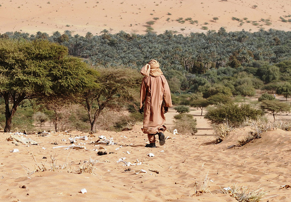
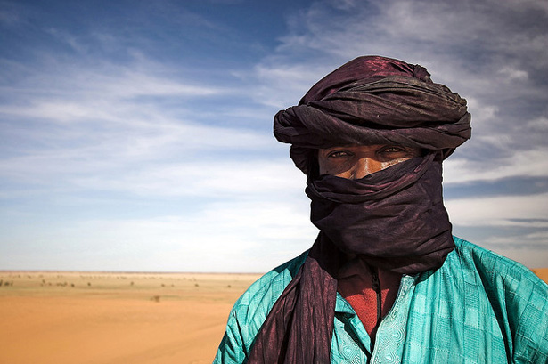
It is the lean season in the Sahel, a spine of arid and dry lands that runs from Senegal to Chad in western Africa, and once again we are seeing the devastating images of children gaunt with hunger. This is a region that faces high childhood malnutrition and underdevelopment even under the best of circumstances so one poor harvest can push millions of the most vulnerable into severe risk. In the aftermath of poor rains, and with food prices stubbornly stuck on high since the food crisis of 2008, some 18.7 million people across eight affected countries in the Sahel are at risk of food insecurity this year alone. At least eight million people are already in need of emergency assistance.
At USAID, we are determined to get ahead of these kinds of chronic crises. We know that millions of Africans living in the dry lands of the Horn and Sahel regions need new solutions. Last year, the worst drought in 60 years ravaged the Horn of Africa, driving 13.3 million people into crisis. And this summer, families in the Sahel are feeling the peril of depleting food supplies, high food prices, and rising malnutrition.
We can’t prevent what appears to be increasing cycles of drought, but we can and are working to create better solutions and build greater resilience among the most vulnerable.
Every crisis is complex, and the Sahel is no exception. A regional drought has been overlaid with instability stemming from the coup in Mali and conflict in the northern part of that country where armed militant groups have forced the suspension of critical relief operations. More than 184,000 refugees have fled to communities in neighboring countries that are already deeply stressed from drought. Though still functioning, local and regional markets have been disrupted, driving food prices even higher. And as of mid-June, swarms of locusts from southern Algeria and Libya had arrived in northern Mali and Niger; now expected to move southward, these infestations could result in crop destruction exacerbating an already worsening situation.
Continue reading on The Huffington Post.
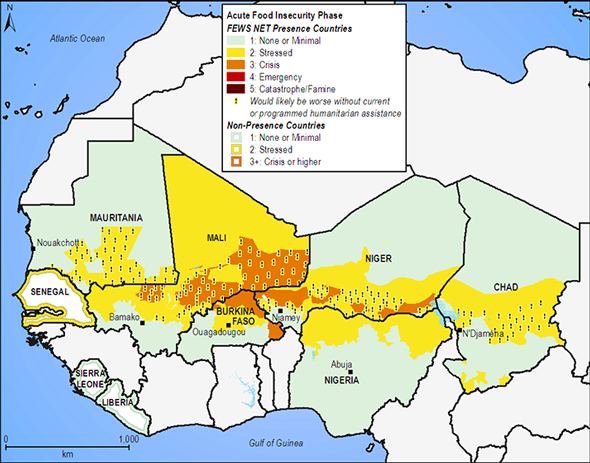
Image Credit: West African medium-term food security outlook, courtesy of the Famine Early Warning Systems Network.
Nancy Lindborg is the assistant administrator of the Bureau for Democracy, Conflict, and Humanitarian Assistance at the U.S. Agency for International Development. -
The Sahel’s Complex Vulnerability to Food Crises
›February 24, 2012 // By Stuart Kent“Across the Sahel region of western Africa, a combination of drought, poverty, high grain prices, environmental degradation, and chronic underdevelopment is expected to plunge millions of people into a new food and nutrition crisis this year,” according to a UN Office for the Coordination of Humanitarian Affairs (OCHA) statement from February 10. The coming “lean season” is predicted to be the third food crisis in less than a decade and highlights a set of glaring vulnerabilities in a region facing severe long-term threats to health, livelihoods, and security. However, as international agencies call for funding to mount yet another emergency response, serious concerns are being raised about what is (or isn’t) being done to address the root causes of vulnerability.
Showing posts from category Sahel.