-
A Blueprint for Action on the U.S.-Mexico Border
›September 17, 2010 // By Robert DonnellyAt the U.S.-Mexico border, environmental degradation is a chief concern affecting both countries’ shared watersheds, “airsheds,” and greater ecosystems. At the same time, continuing population stresses in the U.S. Southwest are further aggravating the area’s perennially acute water needs, while climate change is threatening to make the region even hotter and drier.
Compounding these ecological challenges and their consequent health risks is the fact that the poverty on both sides of the border appears largely intractable, at least in the short-to-medium term. Yet the region and its shared challenges also present unique opportunities for enhanced U.S.-Mexico collaboration, particularly in the areas of joint environmental management, cross-border emergency response, and renewable energy development.
Earlier this summer, the Woodrow Wilson Center’s Mexico Institute looked to address these challenges and opportunities by co-sponsoring an event with the Good Neighbor Environmental Board (GNEB), an independent federal advisory committee (coordinated by the Environmental Protection Agency) that advises the U.S. government on border environmental practices. The event revolved around the release of the board’s new report, A Blueprint for Action on the U.S.-Mexico Border.
Initiatives Show Promise
Chief among the report’s 63 policy recommendations is the need for better coordination among and between federal, state, and local agencies at the border. GNEB Chair Paul Ganster cited the report’s support of a transboundary environmental impact assessment (TEIA) process “to address transnational (environmental) impacts, and encourage transborder cooperation on environmental infrastructure projects.” The report suggests that the trilateral Commission on Environmental Cooperation (CEC)—comprising Mexico, Canada, and the United States—“explore such an agreement.”
Ganster added that U.S. border communities require dedicated focus from the government in ways that non-border communities might not because of their unique and poverty-aggravated environmental challenges.
Michelle DePass, an assistant administrator at the Environmental Protection Agency’s Office of International and Tribal Affairs, said that the board’s findings would be used in the search for solutions to border-region environmental challenges. She acknowledged recent advances in tackling such challenges, such as EPA-coordinated efforts to reduce the serious environmental threat posed by heaps of tires scattered throughout the region.
DePass also described the EPA’s U.S.-Mexico Environmental Program, known as Border 2012, highlighting its successful involvement in efforts to clean up the Metales y Derivados industrial waste site in Baja California.
Nancy Sutley, chair of the White House Council on Environmental Quality, said that the border region is poised to become part of a “clean energy revolution” because of its supply of renewable resources. She lauded the report for encouraging clean-energy collaboration with Mexico, and said the report’s recommendations have a special significance because they are issued by individuals who actually live and work in the border region.
Bilateral collaboration is necessary to mitigate the adverse effects of climate change and to resolve shared environmental problems at the border, said Enrique Escorza, an official with the Political Affairs Section of the Mexican Embassy in Washington, D.C. Escorza said the need for collaboration has finally eclipsed prior impediments, such as concerns about violations of national sovereignty.
“The border throws us together,” Escorza said, adding that Mexico has a new understanding about shared resources. “It’s not about ‘our’ water,” he declared. “It’s about shared watersheds and our working as partners.”
A Federal, State, and Local Stakeholder Perspective
Duncan Wood, acting chair of the Department of International Relations at the Instituto Tecnólogico Autónomo de México (ITAM), noted that the border region presents enormous opportunities in the area of renewable energy investment. The border is a unique region, he added, since ecosystems overlap rather than respect national boundaries. He drew linkages between the report’s policy options for improving the border and two pillars of U.S.-Mexico security cooperation policy: the development of a 21st century border where security and trade concerns complement one another, and the construction of resilient border communities.
Russell Frisbie, the Washington liaison for the International Boundary and Water Commission (IBWC), and John Wood, a county commissioner in Cameron County, Texas, both discussed the need for a bilateral federal-to-federal memorandum of understanding on cross-border emergency-management response. The development of such a protocol could help first responders in both countries more easily cross the border to provide relief in the event of natural disasters, such as floods or wildfires.
Allyson Siwik, executive director with New Mexico’s Gila Resources Information Project, seconded the report’s recommendation for a successful Transboundary Aquifer Assessment Program, which would, according to the GNEB report, “scientifically characterize aquifers that underlie the international boundary and encourage other efforts to improve data gathering and accessibility for border water resources, such as harmonization of standards.” Ann Marie A. Wolf, president of the Sonora Environmental Research Institute (Arizona), called for upgrades to water and wastewater systems in border sister cities, some of which suffer regular overflows from flooding.
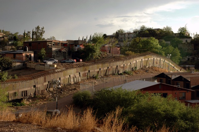
Siwik also stressed an ongoing need to assess the environmental impact of security fencing along the border, which Wood said prevented the natural movement of animal species, while not effectively deterring unauthorized migration.
Robert Donnelly is a program associate with the Mexico Institute at the Woodrow Wilson Center.
Photo credit: “U.S.-Mexico border fence at Nogales, Arizona,” courtesy of flickr user jim.greenhill. -
Floods, Fire, Landslides, and Drought: The Guardian’s “Weather Crisis 2010”
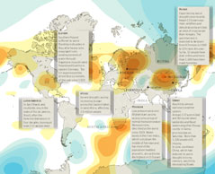
› From the Guardian’s DataBlog comes an excellent overview of some of the extreme weather affecting the globe this summer, from the devastating floods in Pakistan which have inflicted “huge losses” to crops and exacerbated an already tenuous security situation, to the wildfires in Russia which have smothered the capital in dangerous smog and crippled domestic wheat supplies.
“Global temperatures in the first half of the year were the hottest since records began more than a century ago,” writes author and graphic artist Mark McCormick.
The orange areas of the map represent high pressure systems and the blue, low pressure systems, which as explained by Peter Stott of the Met Office, are important indicators of the rare climatic conditions that caused this summer’s abnormal conditions across Eurasia.
The flooding in Pakistan has garnered the most international attention, having now affected more people than the 2004 tsunami, 2010 Haiti earthquake, and 2005 Kashmir earthquake combined. Other highlighted areas of the map include flooding in Poland and Germany, drought in England, mudslides in Latin and South America, record-breaking drought and hunger in West Africa, and flooding and landslides in China, which recently pushed the world’s largest hydroelectric dam to its limit and have now been blamed for more than 1,000 deaths.
Although it does a good job highlighting the frequency and severity of extreme weather events this summer, it’s important to note that the map only covers events in July and August. That leaves out the “1000-year” floods in Tennessee this May as well as the heavy snowfall seen in the Northeast United States and the winter of “white death” in Mongolia earlier this year, which also severely disrupted local and national infrastructure as well as a great many people’s livelihoods.
Sources: Agence France-Presse, BBC, Guardian, National Oceanic and Atmospheric Administration, New York Times, Telegraph, UN Dispatch.
Image Credit: “Weather Crisis 2010” by Mark McCormick, courtesy of Scribd user smfrogers and The Guardian. -
PRB Maps the PHE World
›The Population Reference Bureau (PRB) has created an interactive Google map that highlights population, health, and environmental programs in Africa, Asia, and Latin America. The Population, Health, and Environment (PHE) Map shows the locations of projects that combine improved health services, sustainable natural resource management, and ecosystem conservation.
According to PRB’s Maura Graff and Jason Bremner, “the map aims to give viewers both a sense of the scale of current PHE integration efforts, and specific information about individual organizations, projects, and their location.”
Clicking on a marker will reveal the title of a PHE program, a short description of its goals and outcomes, a link to its website, and the occasional picture of the project in action. A list on the left alphabetically catalogs all the projects based on region.
The map also provides the opportunity for those working on PHE projects in the field to find nearby projects in order to share experiences. For example, in Ethiopia, Population Media Center and DSW’s Youth to Youth could share lessons learned about disseminating information on the reduction of female genital mutilation, the importance of providing family planning services to young married couples, and the linkage between reduced family size and enhanced stewardship of social and natural resources.
Communities that understand how population, health, and environment are intertwined are more engaged and energized to make a difference. In a video interview with ECSP, Roger-Mark De Souza, director of foundation and corporate relations at the Sierra Club, explains that PHE projects are so effective because solutions to a community’s liked problems demand this logical integration. For example, while learning about the health benefits of birth spacing, father and mothers also learn how their family planning decisions can improve the economic and environmental prospects of the community.
Just like PHE projects themselves, the map is a work in progress; PRB is seeking to add PHE projects that are still active or ended after 2005. Please contact Maura Graff if you would like to add a project.
Josephine Kim is a cadet at the United States Military Academy at West Point, and an intern with the Woodrow Wilson Center’s Environmental Change and Security Program. -
Drug Barons, Poachers, Ranchers, Oh My! Guatemala’s Forests Under Siege
›July 29, 2010 // By Kayly OberLast week, the New York Times ran an article about the many threats converging on Guatemala’s Maya Biosphere Reserve. “There’s traffickers, cattle ranchers, loggers, poachers and looters,” Richard D. Hansen, an American archaeologist, told NYT. “All the bad guys are lined up to destroy the reserve. You can’t imagine the devastation that is happening.”
Eric Olson, senior associate of the Mexico Institute at the Woodrow Wilson Center, agrees that drug trafficking is a major problem in the Petén, a region of northern Guatemala that lies within the Biosphere. “Petén’s isolation has made it possible for the biodiversity of the area to survive and thrive during periods of great social turmoil, especially in the 1980s,” Olson told the New Security Beat. “However, the isolation also makes it an ideal place for drug traffickers to move their illegal product northward.”
According to NYT, peasant squatters in search of farmland constitute an additional threat because they “often become pawns of the drug lords,” and, in some instances, “function as an advance guard for the drug dealers, preventing the authorities from entering, warning of intrusions, and clearing land that the drug gangs ultimately take over.”
Plus, the situation seems poised to worsen. According to a UNESCO report, Petén’s population has surged from 25,000 during the 1970s to upwards of 500,000 today. This growth, coupled with an attendant rise in subsistence farming, has had significant environmental impacts across the region.
Population Growth in Protected Areas
“Population has a huge impact on Guatemala’s ecological diversity,” David López-Carr, an associate professor in the University of California-Santa Barbara’s Geography Department, wrote in an e-mail to the New Security Beat. Most striking, according to López-Carr, are total fertility rates in rural areas, which remain “over 5 and much higher still – higher than 6 – in the most remote rural areas where ecological diversity is highest.”
Despite the fact that most migrants move to Guatemala City, smaller cities, or the United States, López-Carr wrote that the “tiny fraction (probably under 5%) that move to remote rural areas have a major impact on biodiversity and forest conversion.” López-Carr pointed out that “in core conservation areas of the Maya Biosphere Reserve, in-migration has swelled the population in some regions by nearly 10% annually during the past two decades.”
At a 2008 meeting at the Woodrow Wilson Center, professors Justin Brashares and George Wittemyer said three factors drive population growth near protected areas in Africa and Latin America: 1) more money for parks (as measured by protected-area funds from the Global Environment Facility); 2) more park employees; and 3) more deforestation on the edges of protected areas.
To avoid population pitfalls, Guatemala’s President Alvaro Colom should take this research into account before putting his “Cuatro Balam” eco-tourism plan into action. The initiative—named for the four main figures in the Mayan creation myth—seeks to divide the reserve into an archaeological park in the north and an agricultural zone in the south, while setting up a Maya studies center for scholars and installing an $8 million electric mini-train to shuttle tourists through the reserve.
The Perils of “Pristine Conservation”
While President Colom’s plan is certainly ambitious, communities in Petén are cautious. They see Cuatro Balam as a continuation of earlier government-funded projects, where “pristine conservation” – oft-touted by large conservation organizations – prohibited human interaction with the forests and limited socioeconomic opportunities for local populations.
Liza Grandia, an anthropology professor at Clark University who has lived and worked in the Peten region, points out in Conservation and Society that “primary” or “pristine” forests flagged as biological hotspots by these conservation organizations are likely remnants of ancient Mayan agroforestry. However, Mayan descendents are not allowed to live within nor manage these areas.
Instead, stewardship of many federal parks is delegated to large conservation outfits or the government. But Rosa Maria Chan, director of ProPeten, a community-based environmental organization, wrote in an e-mail to the New Security Beat that “the environment is not always the government’s priority,” adding that “development” normally signifies large infrastructure projects, instead of smaller-scale ideas that would better address human development.
The Benefits of Community-Based Conservation
One successful local project is the Association of the Forest Community of Péten (ACOFOP), a community-based association made up of 23 indigenous and farming organizations. Under ACOFOP’s direction, uncontrolled settlement in the biosphere reserve has been stopped, communities have ceased the conventional slash-and-burn practices, and forest fires have virtually ceased in community-managed areas. ACOFOP’s projects have also created jobs in local communities, where the beneficiaries re-invest their earnings into collective infrastructure.
In the mid-1990s/early 2000s, ProPeten’s Remedios I and II programs, funded mainly by USAID, used radio soap operas and mobile theaters to educate residents about conservation, reproductive health, nutrition, and sustainable agriculture. Underlying these programs’ success was an unprecedented survey that gathered data on the rapidly changing population-environment dynamics in this frontier region.
Grandia, who served as head of ProPeten’s board of directors from 2003-2005, writes in 2004 Wilson Center article that “the integrated DHS [Demographic and Health Survey] has been a critical part of developing…programs linking health and population with the environment,” which lowered Petén’s total fertility rate from 6.8 to 5.8 children per woman in just four years. Plans are underway to include a similar environmental module in the next DHS survey.
Although the fate of Guatemala’s forests is subject to many outside forces, from the government’s development plans to the cartel’s smuggling operations, small-scale, community-based programs may have the best shot at transforming the drivers of deforestation into sustainable, economic development opportunities.
Photo Credit: “Keel-billed Toucan at Tikal National Park, Guatemala,” courtesy of flickr user jerryoldenettel. -
Stacy VanDeveer: Will Using Less Oil Affect Petrostate Stability?
›July 12, 2010 // By Schuyler NullIf we were to actually use less fossil fuel, what would happen to today’s petrostates? “If the oil revenues dry up or even decline a little bit you might have a real serious crisis,” said Stacy VanDeveer of the University of New Hampshire, during an interview with ECSP. We spoke to VanDeveer following his presentation at the Wilson Center event, “Backdraft: The Conflict Potential of Climate Mitigation and Adaptation.”
-
Time to Give a Dam: Alternative Energy as Source of Cooperation or Conflict?
›July 8, 2010 // By Kayly OberMitigation can be a means to peace, not just conflict, said Stacy VanDeveer in the lead up to Backdraft: The Conflict Potential of Climate Mitigation and Adaptation at the Woodrow Wilson Center on June 10. VanDeveer believes that mitigation techniques, particularly alternative energy sources like hydroelectric dams, could stimulate cooperation rather than exacerbate threats.
-
U.S.-Mexico Cooperation on Renewable Energy: Building a Green Agenda
›Could joint green-energy development help improve relations between the United States and Mexico? Speakers at this spring’s launch of “Environment, Development and Growth: U.S.-Mexico Cooperation in Renewable Energies,” a report released by the Woodrow Wilson Center’s Mexico Institute, agreed that cooperating on renewable energy is a positive step. However, the panelists asserted that cooperation could be maximized by better harnessing Mexico’s renewable resources and by leveraging the economic complementarities that exist among the border states.
Mexico’s Green Energy Potential
Mexico has large untapped areas of geothermal, wind, and solar potential, according to Duncan Wood, author of the Wilson Center report and chair of the Department of International Relations at the Instituto Tecnologico Autonomo de Mexico (ITAM). Already, the country is the world’s third-largest producer of geothermal energy, and has large geothermal deposits in Baja California near major U.S. markets, such as San Diego and Los Angeles.
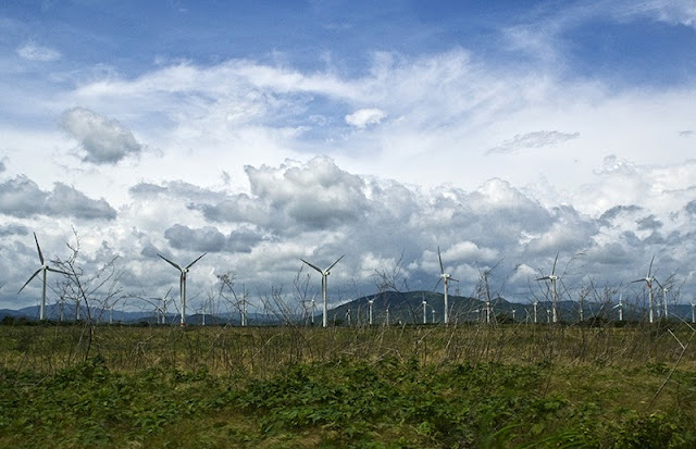
Mexico also offers great promise in wind power, with an estimated potential output of 1,800 to 2,400 megawatts for Baja California and 5,000 megawatts for southern Oaxaca state. Though Oaxaca is far from the U.S. border, it will soon be able to export electricity to U.S. markets, once Mexico’s mainland electrical grid is connected to the United States.
Wood also pointed out that Mexico is rich in solar energy, which could be marketed to the United States—particularly from the Baja California peninsula, which is the only part of the Mexican grid currently connected the United States. In biomass, he added, little investment has been made so far.
Opening New Avenues for Collaboration
With Mexico’s oil fields experiencing long-term and, in some cases, precipitous declines, the country is plotting a “future as a green nation,” shifting its policy focus toward alternative energy development, said Wood. In addition, Mexico’s renewable sector does have not the blanket prohibitions on private ventures that exist in the hydrocarbons sector, and regulatory adjustments over the past few administrations have enabled a more robust private stake in electricity generation and transmission.
A U.S.-Mexico taskforce on renewables was recently formed—an announcement timed to coincide with President Felipe Calderon’s April 2010 state visit to Washington—and there has been high-level engagement on the issue by both administrations. Collaboration between Mexico and U.S. government agencies through the Mexico Renewable Energy Program has enabled richer development of Mexico’s renewable resources while promoting the electrification and economic development of parts of rural Mexico. Joe Dukert, an independent energy analyst affiliated with the Center for Strategic & International Studies, pointed out that U.S.-Mexico collaboration on renewables is a little-acknowledged area of bilateral cooperation, and stressed the economic complementarities that exist between the two countries on the issue. He noted, for example, that Mexico was well-positioned to furnish power to help California meet its Renewables Portfolio Standard (RPS) by 2020.
“Mexico can help them reach these [renewable energy] targets,” Dukert said. Yet at the same time, he said that Mexico needs to do more to enhance its profile as a renewable-energy supplier, and specifically suggested that energy attaches be assigned to the embassy and consulates.
Johanna Mendelson Forman, a senior associate with the Americas Program at the Center for Strategic & International Studies, emphasized the linkages connecting climate change, energy, and economic development. Forman warned that Mexico’s inadequate energy stocks are a problem for the United States, adding that “energy poverty is a real issue in Mexico.” Energy development and climate change—which are perceived as less polemical than other issues—are good entry points for a broader U.S.-Mexico dialogue, she remarked.
Robert Donnelly is a program associate with the Mexico Institute at the Woodrow Wilson Center.
Photo Credit: “Wind Mill Farm (Mexico),” courtesy of flickr user Cedric’s pics. Speaker photos by David Hawxhurst/Wilson Center. -
Urbanization, Climate Change, and Indigenous Populations: Finding USAID’s Comparative Advantage
›May 26, 2010 // By Kayly Ober “Part of the outflow of migrants from rural areas of many Latin American countries has settled in remote rural areas, pushing the agricultural frontier further into the forest,” writes David López-Carr in a recent article in Population & Environment, “The population, agriculture, and environment nexus in Latin America.” In a May 4 presentation at the LAC Economic Growth and Environment Strategic Planning Workshop in Panama City, Panama, he discussed how to integrate family planning and environmental services in rural Latin America.
Latin America is one of the most highly urbanized continents in the world, with an average of 75 percent of the population living in cities. However, “there are two Latin Americas,” said López-Carr at the workshop, which was sponsored by the Woodrow Wilson Center’s Environmental Change and Security Program and Brazil Institute, as well as the U.S. Agency for International Development. Largely developed countries like Chile, Argentina, and Uruguay are close to 90 percent urbanized, while Guatemala, Ecuador, and Bolivia are about 50 percent. In less urbanized countries, rural-rural migrants in search of agricultural land remain a major driving force behind forest conversion, he said.
Between 1961 and 2001, Central America’s rural population increased by 59 percent, said Lopez-Carr. The increasing density of the rural population had a negative impact on forest reserves: a 15 percent increase in deforestation totaling some 13 million hectares.
“Rural areas of Latin America still have high fertility rates but (unlike much of rural Africa, for example) also have a high unmet demand for contraception, meaning that improved contraceptive availability would likely result in a rapid and cost-effective means to reduce population pressures in priority conservation areas,” he said. Additionally, remote rural areas with high population growth rates tend to be associated with indigenous populations located in close proximity to protected forests.
For example, in Guatemala, communities surrounding Sierra de Lacandon National Park have, since 1990, grown by 10 percent each year, with birthrates averaging eight children per woman. Larger communities and larger households have led to agricultural expansion, which infringes on the park and accelerates deforestation in one of the most biologically diverse biospheres in the world, said López-Carr.
Based on these demographic and environmental trends, López-Carr suggested USAID’s work in the region should focus on rural maternal and child health, and education – especially for girls. Not only does USAID already invest in such programs, but they only cost pennies per capita and could reduce the number of rural poor living in Latin American cities by tens of millions.
Given the strong links between population density and deforestation in Latin America, expanding access to family planning would also be a smart investment in forest conservation and climate mitigation, López-Carr concluded.
Source: Population Reference Bureau.
Photo Credit: Dave Hawxhurst, Woodrow Wilson Center.
Showing posts from category Latin America.


