-
Visualizing Complex Vulnerability in Africa: The CCAPS Climate-Conflict Mapping Tool
›“Every crisis is complex, and the Sahel is no exception,” wrote USAID Assistant Administrator Nancy Lindborg in a recent Huffington Post article that called for “smarter programming and a coordivenated response” to chronic crises. “A regional drought has been overlaid with instability stemming from the coup in Mali and conflict in the northern part of that country where armed militant groups have forced the suspension of critical relief operations” and led to refugee movement into neighboring countries simultaneously challenged by drought and crop infestation. Understanding the complexity of this type of crisis, let alone visualizing the multiple factors that come into play, is a growing challenge for policymakers and analysts.
Enter version 2.0 of a mapping tool created by the Climate Change and African Political Stability Program (CCAPS) housed in the Robert S. Strauss Center for International Security and Law, based at the University of Texas, Austin.
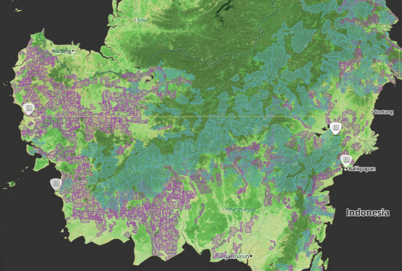
In collaboration with the College of William and Mary, Trinity College, and the University of North Texas, and with funding by the U.S. Department of Defense’s Minerva Initiative, CCAPS originally launched the mapping tool in March of this year. The map is powered by mapping and data tools from Esri and allows users to view any combination of datasets on international development projects, national governance indicators, incidences of conflict, and climate vulnerability data.
With an intuitive interface and compelling visuals, the mapping tool is a valuable resource for policy analysts and researchers to assess the complex interactions that take place among these environmental, political, and social factors. Advanced filters allow the user to identify a subset of conflicts and aid projects and there are nine base map styles from which to choose.
The mapping tool is anything but static. The team is constantly working to refine and enhance it through the inclusion of additional indicators and improvement of the interface. The updated version now includes CCAP’s new Social Conflict in Africa Database, which tracks a broad range of social and political unrest, and their partners’ real-time conflict dataset, the Armed Conflict Location and Event Dataset (ACLED), which tracks real-time conflict data. Impressively, the ACLED data will be updated weekly.
I asked CCAPS program manager Ashley Moran to clarify how the governance indicators work in the model. She explained:The national governance indicators are included in one of four baskets that make up the climate vulnerability model…and represent four potential sources of vulnerability: physical exposure to climate-related hazards, population density, household and community resilience, and governance and political violence. They used the term “basket” since most include several indicators that reflect the full dimensions of that source of vulnerability. The fourth basket includes five national governance indicators and one indicator of political violence.
Moran also shared plans to add more detailed national governance data to the map:We are developing a mapping tool specifically for the climate vulnerability model, which will allow users to see the component parts of the model. It will allow users to re-weight the baskets (e.g. if a user thought governance should have more weight within the model since the government response to climate hazards is key), and it will also allow users to examine an area’s vulnerability to just one or two baskets of the user’s particular interest (instead of all four baskets combined as the tool does now). When we launch this, a user will essentially be able to see the vulnerability model disaggregated into its component parts, so they’ll be able to map just the governance data in the model, if they want.
In the coming months, the CCAPS team will add more detailed historical and projected data on climate vulnerability, data on disaster response capacity, as well as international aid projects coded for climate relevance.
Each of these datasets on their own are a wealth of vital information, but understanding how they intersect and the potential impact of their interactions is crucial to improving our understanding of them individually and collectively and creating responses that are timely and long-lasting.
If you’re in the San Diego area next week, check out Ashley Moran’s presentation of the mapping tool at the Esri International User Conference and the Worldwide Human Geography Data Working Group.
Sources: The Climate Change and African Political Stability Program, The Huffington Post.
Image Credit: CCAPS -
An Update on PRB’s Population, Health, and Environment Project Map
›As reproductive rights advocates reflect on their disappointment with the outcome of last week’s Rio+20 summit, it is encouraging to see that population, health, and environment (PHE) projects – which fundamentally connect women’s health with sustainable development – continue to sprout up around the world. The Population Reference Bureau (PRB) launched their community-supported PHE Project Map in March 2010, and since then, the map has grown to include 76 projects across three continents, and has been viewed more than 82,000 times.
The goal of the map is to show which organizations are doing what PHE work where and when. While the map highlights expected hotspots like Ethiopia, Madagascar, and the Philippines, it also brings into focus countries that may not necessarily come to mind when thinking about PHE – South Africa, Venezuela, and Vietnam being among them. The map is updated on a rolling basis, and has grown substantially during its first two years.
These numbers should offer encouragement to reproductive rights and sustainable development advocates. Even if world leaders are still struggling to integrate these issues into a global development framework, NGOs, local nonprofits, and development agencies across the world are moving full-speed ahead to improve healthcare, strengthen ecosystems, and empower women and men across Latin America, sub-Saharan Africa, and South Asia.
To add a project to the map, contact PRB’s Rachel Yavinksy at ryavinsky@prb.org. -
What Are the Most Important Factors in the Failed States Index?
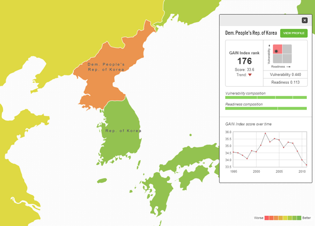
›Last week, the Fund for Peace issued its eighth annual Failed States Index (FSI). The index gives 177 countries a score between 1.0 and 10.0 for 12 indicators, ranging from the legitimacy of the state and the security apparatus to demographic pressure and uneven development (high being bad, low being good – see full descriptions of the indicators here). But which of these indicators has the biggest impact? We did a quick analysis of the Failed States Indexes published from 2006 to 2012 to show which of the indicators correlate most with a high score. (We skipped 2005 since the roster of analyzed countries was significantly smaller.)
-
Alexandra Cousteau on the Global Water Crisis and Choosing Between the Environment and the Economy
›Above is a short discussion filmed after a full dialogue TV episode last week; for the full interview, please visit the Wilson Center.
“We have serious issues that we need to address, yet we’re largely unaware of them because water seems so abundant,” said Alexandra Cousteau in an interview at the Wilson Center. “That myth of abundance is finally reaching an age of limits.”
Cousteau spoke with John Milewski of the Wilson Center’s dialogue TV program, after an event on the recent global water security assessment by the U.S. intelligence community. She discussed the work of her organization, Blue Legacy, which seeks to raise awareness of the ‘global water crisis’ – from degrading quality to growing scarcity and the proliferation of water refugees.
Global Water Crisis
“Traditionally our understanding of the global water crisis has been very narrow,” said Cousteau. “We have talked about it mostly in terms of the very real water and sanitation crisis that is happening in the developing world.” Without minimizing the severity of the situation in developing countries or oversimplifying the tangled nature of their problems, she characterized these water and sanitation struggles as fundamentally “solvable.”
Cousteau argued that there are also substantial water problems in the United States. Pollution due to runoff and over-utilization of major riverways are threats that are much different from those in the past.
“In Nixon’s time, when he signed the Clean Water Act, it was because rivers like the Potomac were in such bad shape, and they could see it from their office windows,” she said. “But the threats to our water are different today…before, it was industrial effluent, and what we were putting in the water that we could see. The Hudson River would change color daily based on the paper mills and what color paper they were printing that day.”
Today, chemicals may impact water quality without changing the appearance of water: “You don’t see it, the water can be perfectly transparent.”
Blue Legacy Expeditions
Cousteau has taken two expeditions with Blue Legacy to highlight water issues around the world. The first in 2009 was global; Cousteau and her team traveled from India to Botswana and beyond. Throughout the voyage, she worked to make her travels accessible to the general public and was surprised at her success.
“It was an experiment, but it worked. And when we came back to the United States, we got a lot of feedback, and one of the things people said was, ‘Gosh, that was an incredible adventure, thanks for taking us along for the ride! Clearly, there is a global water crisis, now I understand that. I’m just so relieved it’s not happening in America.’ And I thought, ‘Oh my Lord, I guess we have an expedition to do in America!’”
Her 2010 North America expedition focused on issues ranging from the over-exploited Colorado River to the polluted Mississippi, and sought to make water problems personal “at a time when our demand on water is at a tipping point.”
The Environment and the Economy
Cousteau’s interview was particularly timely in light of global economic troubles which have led some to say the environment should take a backseat. Cousteau said this doesn’t have to be the case. She emphasized the interconnected nature of the environment and the economy, saying that policymakers don’t have to choose to focus on one or the other.
“We feel like we have to make a choice between the economy and the environment, and that’s a false dilemma. A healthier environment is a more prosperous economy. And when we fail to realize that we don’t have to sacrifice one to have the other, then I think we wind up sacrificing a lot of the quality of life and the opportunity that we take for granted.”
Video Credit: Dialogue/Wilson Center and Alexandra Cousteau. -
Gidon Bromberg at TEDx on Peacebuilding Through Water in the Middle East
›“Cooperation over water is not a privilege, it’s a necessity,” said Gidon Bromberg, co-director of Friends of the Earth Middle East, in a TEDx talk at Yale. He sees the shortage of water in Jordan, Israel, and Palestine as an opportunity to bring these contentious communities together – even more so during this period of upheaval in the region.
Water woes have long contributed to regional tensions, said Bromberg. Water rights between Israel and Palestine were supposed to be settled during the Oslo accords in 1993, but negotiations were unsuccessful and water discussions were consequently left unfinished. The lack of formal negotiations caused each side to seize whatever resources they could Although Jordan was not part of the negotiations, it does share water resources with Israel and the West Bank and thus has been impacted by the lack of formal allocation processes. Both Jordan and Israel have diverted flow of the Jordan River into dams and irrigation projects. As a result, the Jordan River has lost 98 percent of its historic flow and the Dead Sea has lost one-third of its surface area.
Today, Israel has restricted Palestinian water use such that Palestinians have access to water only once a week in winter and once every three weeks in the summer, leading them to store water in containers on their roofs, Bromberg said. Though mismanagement is as much to blame as conflict, he notes, Palestinians chafe under the limitations.
Yet Friends of the Earth Middle East has used this difficult situation to educate the public, propose reforms, and build trust between Palestinian, Jordanian, and Israeli communities. Bromberg highlighted “fear of a small but vocal minority on both sides” as a key factor in preventing dialogue between the communities, but insists that water can bring people together. Neighboring communities have to work together, he said, “not because they’re best friends,” but to improve their own water situations.
Friends of the Earth provides that opportunity with their Good Water Neighbors project and hopes the trust built between communities extends beyond water issues as well. Since communities have strong motives to solve these problems, they work together more effectively than high-level politicians who may not be as apt to collaborate.
A positive update on the state of the Jordan River given in an interview with ECSP in October suggests that Bromberg may be on to something.
Sources: Amnesty International, Friends of the Earth.
Video Credit: TEDx. -
Full Extent of Africa’s Groundwater Resources Visualized for the First Time
›“In Africa, groundwater is the major source of drinking water and its use for irrigation is forecast to increase substantially to combat growing food insecurity,” yet, a lack of quantitative data has meant that “groundwater storage is consequently omitted from assessments of freshwater availability,” according Alan Macdonald, Helen Bonsor, and Brighid Dochartaigh of the British Geological Survey, and Richard Taylor of University College London, writing in Environmental Research Letters.
The authors hope to remedy this with new research presented in “Quantitative Maps of Groundwater Resources in Africa.” They used estimates compiled from geologic data and 283 aquifer summaries from 152 different publications to quantitatively visualize, for the first time, the full extent of Africa’s groundwater resources.
Tapping a Hidden Resource
The study estimates the scale of the continent’s groundwater resources at around 0.66 million km3. This volume, the authors explain, is “more than 100 times the annual renewable freshwater resources, and 20 times the freshwater stored in African lakes.”
Tapping into this massive resource is not always straightforward, however. The largest aquifers, and those most able to support high yielding bores, are concentrated in the arid regions of North Africa. The depth of these aquifers and their distance from major populations creates substantial economic challenges for extraction.
The geographic distribution of aquifers across sub-Saharan Africa is also quite variable, and local geology can determine not just the availability and accessibility of water but also its quality. For instance, geologic specificities can result in elevated levels of arsenic and other undesirable chemicals. Furthermore, “contamination…is common in urban areas from widespread and dispersed faecal effluent from on-site sanitation and leaking sewers.”
Tempering Expectations
Throughout Africa, “groundwater provides an important buffer to climate variability and change,” say the authors. But these buffers are not a singular solution to the threat of future water scarcity.
As the analysis shows, most aquifers, especially south of the Sahara, are unlikely to sustain boreholes of a higher capacity than that required by community-level hand pumps (one liter per second of flow at minimum). Yet, commercial irrigations schemes and urban towns typically demand boreholes greater than five liters per second, according to the study.
So, groundwater extraction may help communities and some small-scale farmers maintain access to water, particularly because many aquifers are found to possess the storage capacity required “to sustain abstraction through inter-annual variations in recharge,” however, “strategies for increasing irrigation or supplying water to rapidly urbanizing cities that are predicted on the widespread drilling of high yielding boreholes are likely to be unsuccessful.” Especially, the authors assert, where drilling precedes detailed local scale mapping of the available resources.
Sources: Environmental Research Letters.
Image Credit: Figures 1 and 3, courtesy of Environmental Research Letters. -
Invest in Women’s Health to Improve Sub-Saharan African Food Security, Says PRB
›“Future food needs depend on our investments in women and girls, and particularly their reproductive health,” says the Population Reference Bureau’s Jason Bremner in a short video on population growth and food security (above). Understanding why, where, and how quickly populations are growing, and responding to that growth with integrated programming that addresses needs across development sectors, are crucial steps towards a food secure future, he says.
Reducing Food Insecurity by Meeting Unmet Needs
In sub-Saharan Africa, where nearly one-fourth of the population lives with some degree of food insecurity, persistently high fertility rates help drive population growth, according to the policy brief that accompanies Bremner’s video.
On average, women in the region have 5.1 children, more than twice the global average total fertility rate (TFR) of 2.5. The United Nation’s medium-variant projections (which Bremner notes are often used to predict future food need) show the region more than doubling in size by 2050, but that projection rests on the assumption that the average TFR will drop to three by mid-century.
As many as two-thirds of sub-Saharan African women want to space or limit their births, but do not use modern contraception. While the reasons for not using modern contraception are many, ranging from cultural to logistical, the lack of funding for family planning and reproductive health services remains a serious impediment to improving contraceptive prevalence and, in turn, lowering fertility rates.
“Current levels of funding for family planning and reproductive health from donors and African governments fail to meet current needs, much less the future needs,” writes Bremner.
Almost 40 percent of the region’s population is younger than 15 years old and has “yet to enter their reproductive years,” writes Bremner. “Consequently, the reproductive choices of today’s young people will greatly influence future population size and food needs in the region.”Fertility Assumptions and Population Projections in the Democratic Republic of Congo
Family Planning Is One Piece of an Integrated Puzzle
Increasing funding for family planning services would be a boon to the region, but Bremner cautions that viewing sub-Saharan Africa’s rapid population growth solely from a health perspective and in isolation from other development needs would be inherently limiting.
“Slowing population growth through voluntary family planning programs demands stronger support from a variety of development sectors, including finance, agriculture, water, and the environment,” Bremner writes. A multi-sector approach that addresses population, health, livelihood, and environment challenges could mitigate future food insecurity more effectively than single-track programming that addresses sub-Saharan Africa’s various development needs in isolation from one another.
Improving women’s role in agriculture, for example, could help minimize food insecurity on a regional scale, Bremner writes. Women make up, on average, half the agricultural labor force in sub-Saharan Africa, and yet it is more difficult for them to own arable land, obtain loans, and afford basic essentials like fertilizer that can help boost agricultural productivity. Furthermore, women’s traditional household responsibilities, like fetching water, often cut into the amount of time they are able to give to farming. With those limitations lifted, women could offer enormous capacity for meeting future food needs.
Given the complex and interconnected nature of the development challenges facing sub-Saharan Africa, integrated cross-sector programming, with an emphasis on meeting family planning needs, is essential to reducing total fertility rates while improving food security over the long-term, according to Bremner.
“Investments in women’s agriculture, education, and health are critical to improving food security in sub-Saharan Africa,” he writes.
“Improving access to family planning is a critical piece of fulfilling future food needs,” he adds, “and food security and nutrition advocates must add their voices to support investments in women and girls and voluntary family planning as essential complements to agriculture and food policy solutions.”
Sources: Population Reference Bureau.
Video Credit: Population Reference Bureau. -
Peacemakers or Exclusion Zones? Saleem Ali on Transboundary Peace Parks
›“Traditionally, natural resources have been thought of as a source of conflict…but what we’ve been trying to do is look at the other side of the story, which is that natural resources, in terms of their quality, can create that impulse for conservation and cooperation,” said Saleem Ali, professor of environmental studies and director of the Institute for Environmental Diplomacy and Security at the University of Vermont, while speaking at the Wilson Center.
This narrative around peace parks or transboundary conservation areas that are used for peacebuilding is a relatively recent field of research, said Ali. “It’s one thing to have a protected area on a border and have cooperation between friendly parties – like the U.S. and Canada,” he said, “and it’s a totally different thing to explore this in areas where there’s a history of protracted violent conflict.”
Yet, Ali said, we have “a good institutional framework for understanding what kind of parks could potentially be developed.” Cooperation between Ecuador and Peru in the Cordillera del Condor protected area, for example, is an incidence where transboundary conservation was actually written into the peace process between two warring states. Recent tragedies on the Siachen glaciers highlight another case where calls have been made to use peace parks as a way to demilitarize a contentious border over which India and Pakistan have long argued.
Questions remain though about the capacity of conservation processes to sustain peace, and “whether micro-conflicts that might arise through any conservation being practiced can be managed effectively.” Peace parks established in South Africa after apartheid, for example, produced “micro-conflicts between the haves and the have-nots – the classic conflict between conservation as an exclusionary arena versus a more inclusionary vision.”
“A lot of those organizations have learned from those past mistakes and we’re moving in the right direction,” Ali said, “but that’s still an area that requires far more research, and also more applied work, to find the right mix of conservation and economic development.”
Showing posts from category Eye On.