-
How Environmental Geopolitics Expands Our Understanding of Risk and Security
June 15, 2020 By Shannon O’Lear
The coronavirus has everyone weighing risk and security within a sliding scale of geographic connections and boundaries. Dots and circles of infection pack our virus maps. We more clearly see the fragility of commodity chains that structure our food systems and energy supplies. The virus easily crosses state borders while security protocols within states have been focused on boundaries between individuals and speech droplets. In many ways, human interaction with this microbe illustrates why an environmental geopolitics perspective is powerful.
A new book, A Research Agenda for Environmental Geopolitics, which I edited, shows how environmental geopolitics, as a perspective, disrupts our understanding of environment-related risk and security. Environmental geopolitics offers a way to break down or decode political statements about environmental features. Concepts such as “climate security” or “resource conflict” may initially seem clear or obvious, but environmental geopolitics allows us to see what kinds of assumptions, knowledge, and agendas hold those statements together. Once we see how those concepts are held together to promote a certain understanding of the world, we can also see how those concepts may limit our understanding or silence alternative perspectives. In short, environmental geopolitics offers a way to question mainstream understandings of human-environment interactions so that we have a more complete picture of political and physical processes and why how we fit those together matters.
Measuring and Interpreting the Environment
Although we tend to think of the environment as external to or somehow separate from humans and our societies, it is clear that human and environmental systems change each other through interactions. When we talk about risk or security in any way related to environmental features, where we draw the line between human stability and environmental disruption matters. How we measure and interpret environmental features to understand, communicate, and respond to what appear to be security threats or risks also matters.
For instance, do we define ecosystem health from a starting point of pristine, untouched conditions? Or do we assess ecosystem health within a context of human interaction? How we answer that question determines the measurements we use to track the resilience and sustainability of an ecosystem. It will also shape how we generate management schemes and policy responses. What parts or aspects of environmental features are measured, how, how frequently, at what spatial scale, and in relationship to what other kinds of information? Any information or data that we derive from these measurements might be used in any number of ways or arguments to justify certain actions or inactions. So it is important to pay close attention to how we measure environmental features and how those interpretations inform claims about risk or security.
Mapping Risk and Security
Geographers read maps for the stories they both reveal and hide. Maps are not objective statements about the features they depict; they are more like a story told from a particular perspective. A cartographer, like a storyteller, can select and emphasize certain kinds of knowledge or data and also choose not to use other elements or representations. Maps, then, are a means of making or creating places. How environmental features are portrayed in maps shape public opinion, policy debates, and decisions that guide how we do or do not interact with the features in question.
For instance, efforts to promote biological conservation on the high seas, areas beyond the control of sovereign states, rely on certain calculations and measurements to portray specific interpretations about the environmental features in question. Our understanding of, for instance, fishing activity, is shaped by the data and the measurements chosen and depicted on maps. For any map or visualization, some data and interpretations are not prioritized or made visible, which raises questions of whose geographical knowledge is legitimized (and whose is obscured) in visualizations about environmental features.
Selective spatial focus
Environmental geopolitics is a way to recognize that the place or spatial scale of any particular understanding of environmental risk or security is usefully informed by zooming out to broader perspectives as well as zooming in to place-specific context. For instance, there has been much speculation about the risks and security implications of a newly traversable open ocean in an ice-free Arctic. In order to understand what is happening in the Arctic Ocean, it is necessary both to zoom out to understand trends happening at a larger scale than the Arctic such as global resource markets. At the same time, we should zoom in to see trends unfolding within the Arctic region such as land-based transportation issues.
Not only is trans-Arctic shipping not cost effective for international shipping companies, it is not necessarily the kind of transport littoral economies want most. There is growing, global market demand for land-based resources such as minerals in the Arctic, and inland railroad transportation is expensive. Analysis of shipping data shows that short, coastal shipping trips to support land-based, extractive industries is the kind of shipping that is most rapidly increasing in the Arctic, not trans-Arctic shipping.
We know the environment—however defined and measured—is changing. We seem slower to accept the implications, however, for geopolitical realities. The familiar, territorial sovereign state system and structures of decision-making are apparently taken for granted as stable. They are understood as the basis for moving forward in a changing environment that must somehow be managed. Environmental risk and threat need to be managed, and predictable environmental spaces and supplies must be secured through political and economic means. Yet isn’t it precisely these systems of power that pose a threat to the environment?
As for the coronavirus and its multiple and multi-layered impacts, it offers sobering lessons in both borders and geography. The state political borders we assume will keep us safe and maintain predictable order have proven to be quite porous. The unfolding geographies of microbe diffusion, food supply bottlenecks and scarcities, and opposing trends in economic and environmental health show why we need to develop new and more comprehensive geographical knowledge. This knowledge would go beyond traditional, territorial geopolitics to recognize ways in which people and places are connected and disconnected through uneven patterns of mobility. We would realize that current systems of political and economic power often operate at the expense of ecological systems, and that social values should determine what kinds of science are most needed or appropriate.
Once we can see the geographical knowledge and power structures at work, we can then move towards more active and engaged scholarly inquiry and policy intervention. We can visualize and implement more just and less violent practices as citizens, consumers, and residents of Earth.
This blog post is based on the recently released book, “A Research Agenda for Environmental Geopolitics,” edited by Shannon O’Lear.
Shannon O’Lear is a Professor at the University of Kansas with appointments in the Geography and Atmospheric Science Department and in the Environmental Studies Program, and the author of “Environmental Geopolitics.”
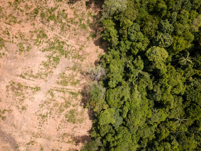
Photo Credit: Shutterstock.com, All Rights Reserved.
 A Publication of the Stimson Center.


