-
Report: Deadly Miscues on the Brahmaputra an Argument for More Transboundary Cooperation
September 26, 2016 By Victoria Johnson
Over the course of 1,800 miles, 5,300 vertical feet, and at least five name changes, the Brahmaputra River, in sometimes turbulent outbursts, flows from the Tibetan plateau to the Bay of Bengal. Along the way, it crosses three countries, including major geopolitical rivals China and India, and supplies 90 percent of downstream Bangladesh’s freshwater during the dry season.
Competition for this essential resource has always been fierce, but climate change is raising the stakes even higher. Climate change is decreasing the amount of water in the Brahmaputra basin, and changing the patterns of water flow, according to a report by CNA, a defense-focused research organization based in Washington, DC.
The report documents how climate change is acting as a threat multiplier for already-heightened water tensions and border conflicts dating back to the 1962 Sino-Indian War. There are no bilateral or multilateral water agreements between states in the basin, and there have already been deadly episodes of miscommunication, demonstrating the need for more transparency and collaboration to prevent this source of sustenance for millions from becoming a security flashpoint.
Crossing Signals
In June of 2000, farmers in Arunachal Pradesh saw the Brahmaputra suddenly rise 120 feet and wash out fields and people, killing 30 and leaving 50,000 homeless. A second flood struck the area two months later, killing another 100 people. The causes of the floods are still disputed. China claims they were due to heavy rainfall in India, but Indian records show no rainfall or evidence of anything unusual when the floods struck. Suspicions in India fell on Chinese dam building or the intentional breaching of temporary lakes caused by landslides without prior warning. A report by the Indian Space Research Organization allegedly found satellite imagery of large bodies of water in Tibet upstream that had recently emptied.
The river suddenly rose 120 feet, washing out fields and peopleThen in March 2012, Indian farmers in Arunachal Pradesh again found the Brahmaputra acting strangely. The normally gushing river was a mere trickle of its usual force, according to reports, so low it could be walked across without getting your feet wet in some places. An Indian scholar publically accused China of diverting water for the Zangmu Dam. Chinese authorities were quick to dismiss the accusation, with a foreign ministry spokesman, who happened to be in India that day, telling the press the dam does not have enough capacity to affect downstream flow.
These incidences badly damaged Indo-Chinese relations, according to CNA, and have left lingering fears. China is currently expanding its “Open Up the West” development campaign, which includes plans to build four more dams on the Brahmaputra in Tibet (known as the Yarlung Tsangpo there). Chinese officials have declared all the dams will be “run of the river” and won’t impact flows to India, but there are worries they will give China the ability to divert or store water in periods of political crisis.
China’s Grand Western Water Diversion Plan could also make an impact, diverting up 60 percent of the Brahmaputra’s flow to China’s arid north. China has dismissed the plan as not feasible, but India and Bangladesh worry that the increasing need for power and unstable water levels from climate change could prompt a reconsideration in the future.
The Brahmaputra River is fed from the snowmelt of the Himalayan Mountains. Climate change will decrease the snow pack in these mountains, according to some studies, resulting in reduced and less stable flows through the basin. The international community has encouraged both China and India to supplement coal with hydropower as a clean source of energy, but this reduction and variability of flows could complicate plans.
India uses only about 20 percent of the potential power of the Brahmaputra, according to some estimates, and is planning to harness additional hydropower through more dams. In addition, as part of Narendra Modi’s grand river-linking project, India has plans to divert more water from the Brahmaputra, through canals, before it crosses the border into Bangladesh.
In fact, even as India is quick to cry foul over China’s handling of upstream development, Bangladesh, the poorest of the three countries, has similar complaints with New Delhi.
“We can only expect the competition…in these increasingly contentious transboundary basins will expand”Bangladesh is the last stop on the Brahmaputra before it reaches the Bay of Bengal and some 100 million Bangladeshis rely on the river during the dry season. Bangladesh is also perhaps the most vulnerable to the water-related impacts of climate change. Climate change is causing India and Bangladesh to experience more rain in the monsoon season, and less rain in the dry season. In response, India has built dams on the Teesta River, a tributary of the Brahmaputra, to collect and regulate flow. The dams allow India to utilize the flow of the Teesta during the dry season, preventing the river from supplying Bangladesh with irrigation water. Heavy rains trigger the release of excess water, though, which can cause havoc downstream and Bangladesh claims sometimes comes with little warning.
“The pressures of climate change will…create increasing incentives to build the sorts of infrastructure that may not have been as urgently needed 10, 20, 30 years ago,” said Claudia Sadoff, an economist at the World Bank, at a panel discussion for the CNA report. “On top of that is the ever growing hunger for hydropower, and what you have is a situation in which we can only expect the competition for water resources in these increasingly contentious transboundary basins will expand in the future.”
Toward Transparency?
The mysterious flooding and drying instances, competing plans for development, and continued political tensions are strong arguments for a new approach to transboundary cooperation in the Brahmaputra basin. The CNA report makes the case that now is the time to create institutions that will develop mutual trust as development plans are made, proactively heading off tensions before the region goes into a full-blown water security crisis. In particular, there needs to be policy around upstream dam building and diversion projects for China and India.
The report also recommends the three main basin states (Bhutan is not studied in depth because it is not a riparian) establish a Brahmaputra Basin Commission, where information can be shared about future plans and current conditions, disaster response can be coordinated, and disputes mediated. Establishing negotiations over non-consumptive uses of water (e.g., for downriver trade, transportation, and ecological sustainability) should be a priority. Having these agreements in place would create a foundation for stable diplomatic relations between the two superpowers, and realistic planning for Bangladesh.
CNA suggests a role for the research community is in establishing baseline measurements of how climate change is affecting the basin. Such measurements are crucial to understanding what populations reliant on the river should expect and how infrastructure will alter its flow. “It is really important, before countries can cooperate to try and achieve a consensus on what the baseline facts are,” said Nilanthi Samaranayake, lead author of the report and a CNA analyst.
Once a foundational understanding of what to expect is established, the report suggests countries be transparent about plans for development to avoid charges from neighbors concerned about their share of water. Since 2002, China, India, and Bangladesh have agreed to share some hydrological data and information about natural disaster response planning during the flooding season. These small steps could be built on to establish a more collaborative future for the basin.
Victoria Johnson was an intern for the Environmental Change and Security Program for the summer of 2016.
Sources: American University, CNA, Daily Mail, The Daily Star, Future Directions International, GRID-Arendal, Hydrology and Earth System Sciences, India Today, IndiaToday, Institute of Peace and Conflict Studies, InterAction Council, Newsweek.
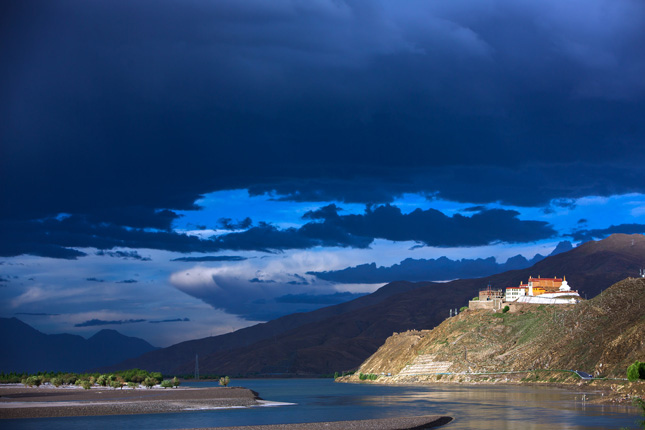
Photo Credit: Tibetan temple on the Yarlung Tasangpo River, China, courtesy of flickr user Feng Zhou.
Topics: adaptation, Bangladesh, Bhutan, China, Choke Point, climate change, conflict, consumption, cooperation, development, disaster relief, energy, environment, environmental peacemaking, environmental security, featured, flooding, foreign policy, hydropower, India, international environmental governance, natural resources, security, South Asia, water
 A Publication of the Stimson Center.


